Arequipa and the Colca Canyon make one of the most rewarding pairings in southern Peru. In a few days you move from a colonial city built of volcanic stone to a deep canyon where condors glide at eye level and farming villages still work terraces built centuries ago. This guide covers what to see in each place, how to plan the road between them and how much time to set aside.
Arequipa at a Glance: Volcanoes and White Stone
Arequipa is Peru’s second-largest city and sits at about 2,335 m a.s.l., high enough to start adjusting to altitude but low enough to feel comfortable from day one. Its historic center was declared a UNESCO World Heritage Site in 2000.
Why the city is built from sillar
Most colonial buildings are made of sillar, a white volcanic stone formed from compacted ash. It is light, easy to carve and resistant to earthquakes, which explains the detailed facades on churches and mansions. The stone is also the reason Arequipa is known as the White City.
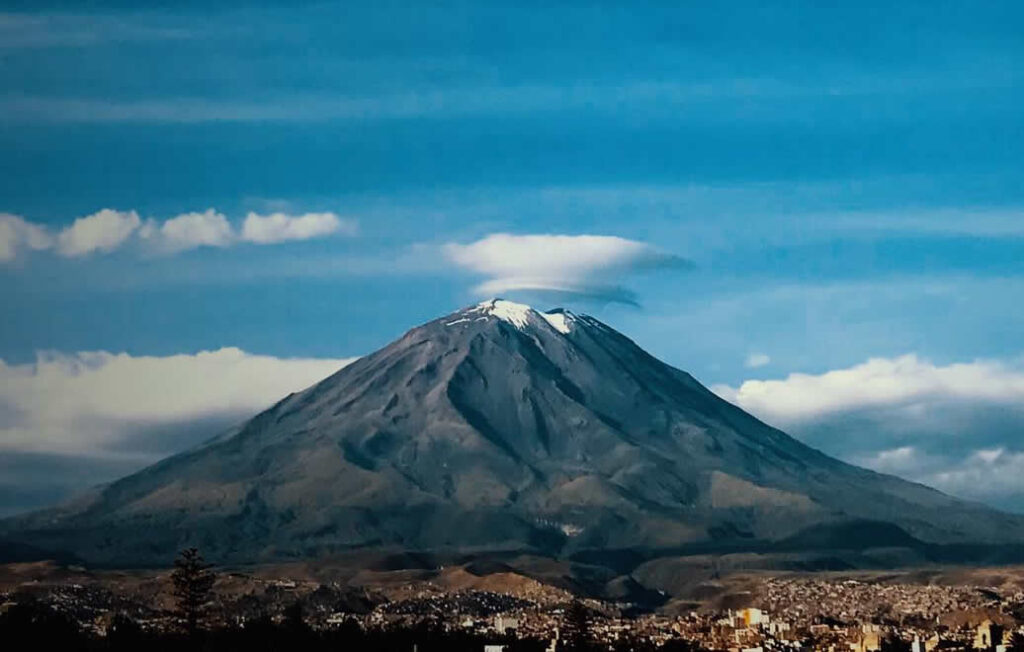
Misti, Chachani and Pichu Pichu on the skyline
Three volcanoes frame the city. El Misti, at 5,822 m a.s.l., is the near-perfect cone you see from almost every rooftop. Chachani, at 6,057 m a.s.l., is the highest of the three, and Pichu Pichu stretches out to the east. On clear mornings, which are common here, all three are visible at once.
A Walking Route Through the Historic Center
Plaza de Armas and the Cathedral
Start at the Plaza de Armas, surrounded on three sides by arched sillar arcades and on the fourth by the Cathedral, one of the longest church facades in Peru. The Cathedral tour takes you onto the roof for close views of the bell towers with El Misti behind them.
Santa Catalina Monastery
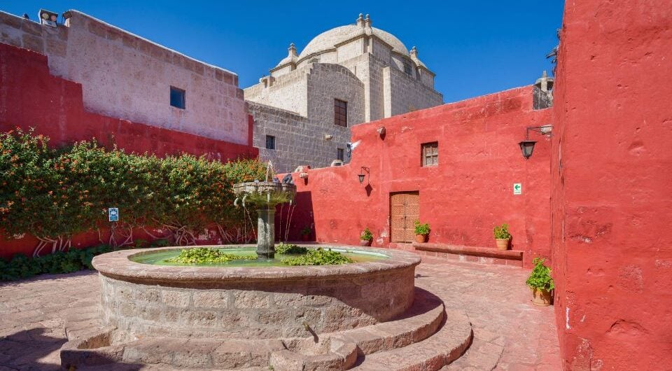
Founded in 1579, Santa Catalina covers around 20,000 m² and feels like a small town inside the city. Narrow streets painted in deep blue and orange connect cloisters, kitchens and the private cells where nuns lived in isolation for centuries. Plan at least two hours, or visit in the late afternoon when the light softens the colors.
Juanita at the Museo Santuarios Andinos
This museum holds Juanita, an Inca girl offered in a ritual on Ampato volcano more than 500 years ago and found in 1995. The guided visit explains Inca mountain ceremonies and shows the textiles and objects buried with her. Depending on the season, a different mummy may be on display while Juanita is preserved.
Yanahuara viewpoint
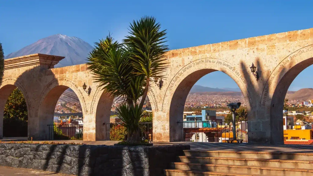
A short taxi ride from the center, the Yanahuara district has a viewpoint lined with sillar arches carved with verses by local poets. It frames El Misti perfectly and is a calm spot to finish the day.
Picanterías and the Dishes That Define Arequipa
Arequipa has one of the strongest regional cuisines in Peru, and the best place to try it is a picantería, a traditional lunch house that serves hearty dishes at long shared tables.
Rocoto relleno and adobo
Rocoto relleno is a spicy red pepper stuffed with seasoned beef, onions and olives, baked with cheese on top and usually served with a potato cake. Adobo arequipeño is a pork stew marinated in chicha and spices, traditionally eaten on Sunday mornings. Chupe de camarones, a creamy river shrimp soup, is another local classic.
Queso helado
Despite its name, queso helado has no cheese. It is a frozen dessert made with milk, coconut, cinnamon and cloves, sold by street vendors around the plazas.
The Road from Arequipa to the Colca Valley
The drive to Chivay, the main town in the valley, covers about 160 km and takes 3 to 4 hours. The route climbs steadily, so it doubles as a lesson in acclimatization.
Vicuñas at Pampa Cañahuas
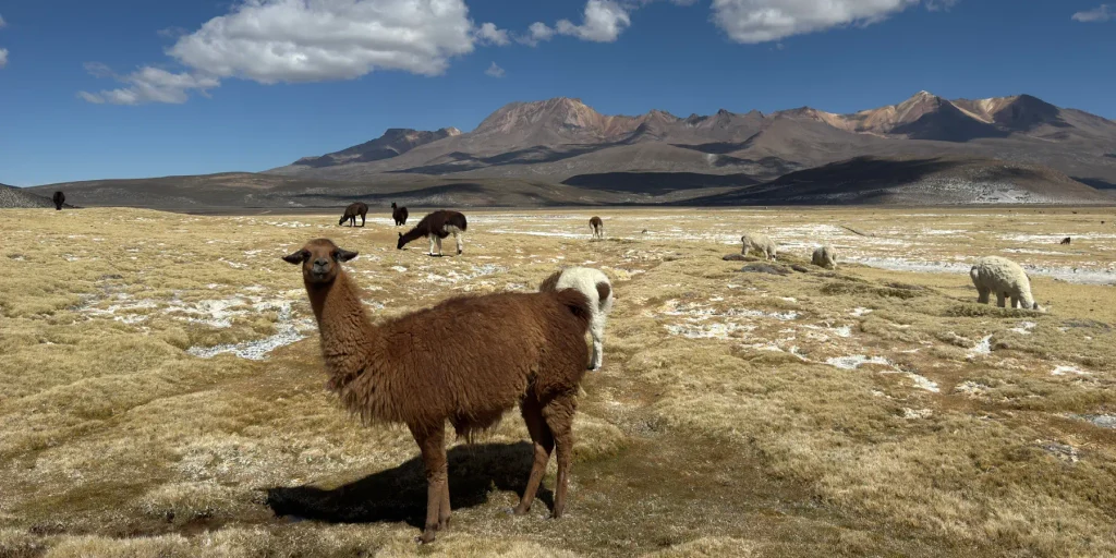
Inside the Salinas and Aguada Blanca National Reserve, the road crosses open grassland where wild vicuñas graze close to the highway. Most drivers stop so you can watch them and photograph the snowcapped peaks behind.
Patapampa pass
The highest point of the route, often called the Mirador de los Andes, reaches around 4,910 m a.s.l. From here you can see a line of volcanoes including Ampato and Sabancaya. Travelers leave small stone piles called apachetas as offerings.
Staying comfortable at the highest point
Move slowly when you get out of the vehicle and keep the stop short. Coca tea during breakfast and plenty of water on the road help, and the descent to Chivay brings quick relief.
Chivay, Hot Springs and Terraced Villages
Chivay sits at about 3,635 m a.s.l. and works as the base for exploring the valley. In the afternoon, the La Calera hot springs are the classic way to relax after the drive. The villages of Yanque, Maca and Coporaque have colonial churches, local markets and women wearing embroidered hats that identify their community, either Collagua or Cabana. The terraces that cover the slopes are still farmed today.
Cruz del Cóndor: Timing Your Visit to See Condors
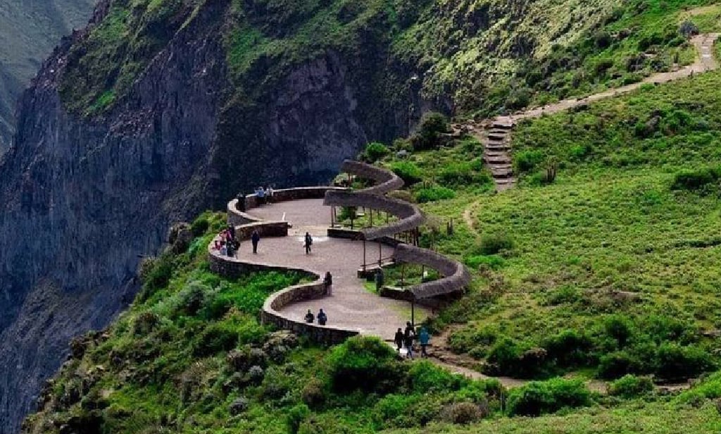
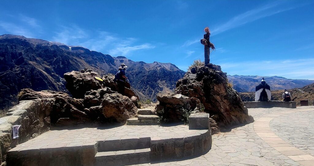
The Colca Canyon reaches more than 3,000 m deep in some sections, making it one of the deepest canyons in the world. At the Cruz del Cóndor viewpoint, Andean condors ride the warm air currents rising from the canyon floor. Arrive between 8:00 and 10:00 a.m., when the air starts to warm and the birds leave their nests. Sightings are most common from April to December and less predictable in the rainy months.
One, Two or Three Days in Colca
A one-day tour from Arequipa is possible but demanding, with a 3:00 a.m. departure and around 15 hours of travel. Two days, with a night in Chivay, lets you enjoy the hot springs and reach the viewpoint at the right hour without rushing. Three days suits hikers who want to walk down into the canyon to the Sangalle oasis and climb back out, a strenuous but memorable trek.
Weather Patterns Across the Year
Arequipa has sunshine for most of the year, with cool nights and dry air. In Colca, April to November brings clear skies and cold mornings, while January to March brings afternoon rain, green terraces and occasional landslides on the road. Nights in Chivay are cold in any season, so pack warm layers even if Arequipa feels mild.
Continuing from Colca to Puno
Instead of returning to Arequipa, you can drive directly from Colca to Puno in about 6 hours, crossing high plateaus with lagoons and flamingos. This route keeps you at altitude and brings you to the shores of Lake Titicaca already adapted, which makes the islands and the lake far more enjoyable.
Where Arequipa Fits in a Longer Peru Trip
Arequipa works best as the step between the coast and the high Andes. After Paracas or Nazca, a few days here let your body adjust before Colca, Puno and Cusco. If you want that sequence already planned, our 12-day Peru tour connects Arequipa with Nazca, Lake Titicaca and Machu Picchu in a gradual climb.
Frequently Asked Questions
How many days should I spend in Arequipa?
Two full days cover the historic center, Santa Catalina and a picantería lunch. Add at least two more for the Colca Canyon.
Is the Colca Canyon deeper than the Grand Canyon?
Yes. In its deepest sections, Colca is roughly twice as deep as the Grand Canyon, although its walls are less exposed.
Do I need a tourist ticket to enter the Colca Valley?
Yes. Visitors pay a tourist ticket at a checkpoint on the way to Chivay, which covers the main viewpoints. Tours usually do not include it, so carry cash.
Is Arequipa a good place to adjust to altitude?
Yes. Its moderate height makes it a comfortable first step before higher places like Colca, Puno and Cusco.
Can I see condors every day?
Sightings are frequent but never guaranteed. Your chances improve in the dry season and in the early morning.
Is it safe to walk around Arequipa at night?
The historic center is lively and generally safe in the evening. Use registered taxis to return to your hotel if you are staying outside the center.